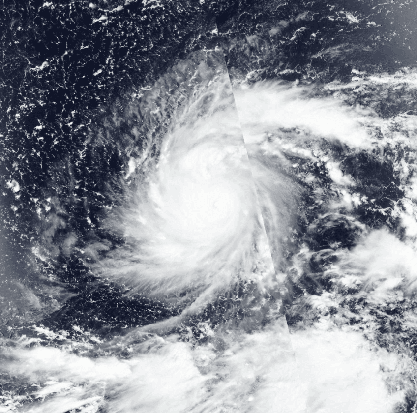
Typhoon Dolphin’s rapid intensification to super typhoon strength over the western Pacific, followed by eyewall replacement cycles that allowed it to maintain Category 4-equivalent winds near 210 km/h, positioned it to reach Japan’s Okinawa region at very strong intensity. Japan Meteorological Agency observations and model consensus tracked central pressures near 945 hPa and sustained winds qualifying for the “very strong” threshold right at landfall, aligning with historical analogs for late-summer western Pacific systems under El Niño conditions that favor prolonged high intensity. Trader consensus reflects these verified track and intensity data, though an unexpected late-stage weakening from increased shear or cooler waters could have altered the outcome before impact.
Experimental AI-generated summary referencing Polymarket data. This is not trading advice and plays no role in how this market resolves. · UpdatedWhat intensity will Typhoon Dolphin have at landfall in Japan?
What intensity will Typhoon Dolphin have at landfall in Japan?
Very Strong Typhoon 100.0%
Tropical Storm <1%
Severe Tropical Storm <1%
Typhoon <1%
$49,630 Vol.
$49,630 Vol.
Tropical Storm
No
Severe Tropical Storm
No
Typhoon
No
Very Strong Typhoon
Yes
Violent Typhoon
No
No Qualifying Landfall
No
Very Strong Typhoon 100.0%
Tropical Storm <1%
Severe Tropical Storm <1%
Typhoon <1%
$49,630 Vol.
$49,630 Vol.
Tropical Storm
No
Severe Tropical Storm
No
Typhoon
No
Very Strong Typhoon
Yes
Violent Typhoon
No
No Qualifying Landfall
No
Resolution is determined by the Japan Meteorological Agency's (JMA) position advisories placing the storm over Japanese land (https://www.jma.go.jp/bosai/map.html#contents=typhoon&lang=en), or by credible international news reporting confirming the storm hitting Japanese territory. The applicable advisory is selected as follows: if a JMA advisory plots the center on Japanese land, that advisory's wind speed resolves the market; if no JMA advisory plots the center on land but credible reporting confirms a crossing occurred between discrete advisory fixes, the intensity is taken from the most recently issued JMA advisory prior to the confirmed crossing time. Once the applicable advisory is identified, its intensity fixes the outcome; no subsequent real-time advisory, reclassification, or post-season best-track reanalysis may retroactively change the outcome.
Archival evidence of JMA advisory data is maintained by the Digital Typhoon database (National Institute of Informatics, Japan) at its Typhoon Images and Charts page for Typhoon 202613 (DOLPHIN). In the event of a resolution dispute, the intensity value recorded by Digital Typhoon for the applicable advisory fix shall be treated as conclusive evidence of what JMA reported.
JMA position advisories are the primary resolution source. If a JMA advisory plots the center on Japanese land, the market resolves based on that advisory's wind speed regardless of what other sources say. If no JMA advisory plots the center on land but credible reporting confirms a crossing occurred between discrete advisory fixes, the market still resolves, with intensity taken from the most recently issued JMA advisory prior to the confirmed crossing time. A disagreement exists only when a JMA advisory and credible reporting make contradictory claims about the storm's position at the same point in time; in that case, JMA is the default resolution source. Only the first qualifying landfall on Japanese territory resolves the market; subsequent landfalls are disregarded.
This is a purely geographic criterion: the storm's center must pass over Japanese land, regardless of whether JMA formally designates the event as "landfall" or "passage." The applicable JMA advisory (as selected above) must show maximum sustained winds of 34 knots or higher, classifying Dolphin as a tropical storm or above. If the applicable advisory classifies the system as a tropical depression (below 34 kt), extratropical, dissipated, or absorbed, the crossing does not count and the market resolves to "No Qualifying Landfall."
This market resolves "No Qualifying Landfall" if Dolphin has been declared extratropical, dissipated, or absorbed on or before August 15 without having made landfall on Japanese territory, if the applicable advisory at the time of crossing shows winds below 34 knots, or if no landfall has physically occurred by the close of August 15, 2026.
Market Opened: Aug 4, 2026, 1:25 PM ET
Resolver
0x69c47De9D...Outcome proposed: No
No dispute
Final outcome: No
Resolution is determined by the Japan Meteorological Agency's (JMA) position advisories placing the storm over Japanese land (https://www.jma.go.jp/bosai/map.html#contents=typhoon&lang=en), or by credible international news reporting confirming the storm hitting Japanese territory. The applicable advisory is selected as follows: if a JMA advisory plots the center on Japanese land, that advisory's wind speed resolves the market; if no JMA advisory plots the center on land but credible reporting confirms a crossing occurred between discrete advisory fixes, the intensity is taken from the most recently issued JMA advisory prior to the confirmed crossing time. Once the applicable advisory is identified, its intensity fixes the outcome; no subsequent real-time advisory, reclassification, or post-season best-track reanalysis may retroactively change the outcome.
Archival evidence of JMA advisory data is maintained by the Digital Typhoon database (National Institute of Informatics, Japan) at its Typhoon Images and Charts page for Typhoon 202613 (DOLPHIN). In the event of a resolution dispute, the intensity value recorded by Digital Typhoon for the applicable advisory fix shall be treated as conclusive evidence of what JMA reported.
JMA position advisories are the primary resolution source. If a JMA advisory plots the center on Japanese land, the market resolves based on that advisory's wind speed regardless of what other sources say. If no JMA advisory plots the center on land but credible reporting confirms a crossing occurred between discrete advisory fixes, the market still resolves, with intensity taken from the most recently issued JMA advisory prior to the confirmed crossing time. A disagreement exists only when a JMA advisory and credible reporting make contradictory claims about the storm's position at the same point in time; in that case, JMA is the default resolution source. Only the first qualifying landfall on Japanese territory resolves the market; subsequent landfalls are disregarded.
This is a purely geographic criterion: the storm's center must pass over Japanese land, regardless of whether JMA formally designates the event as "landfall" or "passage." The applicable JMA advisory (as selected above) must show maximum sustained winds of 34 knots or higher, classifying Dolphin as a tropical storm or above. If the applicable advisory classifies the system as a tropical depression (below 34 kt), extratropical, dissipated, or absorbed, the crossing does not count and the market resolves to "No Qualifying Landfall."
This market resolves "No Qualifying Landfall" if Dolphin has been declared extratropical, dissipated, or absorbed on or before August 15 without having made landfall on Japanese territory, if the applicable advisory at the time of crossing shows winds below 34 knots, or if no landfall has physically occurred by the close of August 15, 2026.
Resolver
0x69c47De9D...Outcome proposed: No
No dispute
Final outcome: No
Typhoon Dolphin’s rapid intensification to super typhoon strength over the western Pacific, followed by eyewall replacement cycles that allowed it to maintain Category 4-equivalent winds near 210 km/h, positioned it to reach Japan’s Okinawa region at very strong intensity. Japan Meteorological Agency observations and model consensus tracked central pressures near 945 hPa and sustained winds qualifying for the “very strong” threshold right at landfall, aligning with historical analogs for late-summer western Pacific systems under El Niño conditions that favor prolonged high intensity. Trader consensus reflects these verified track and intensity data, though an unexpected late-stage weakening from increased shear or cooler waters could have altered the outcome before impact.
Experimental AI-generated summary referencing Polymarket data. This is not trading advice and plays no role in how this market resolves. · Updated

Beware of external links.
Beware of external links.
Frequently Asked Questions