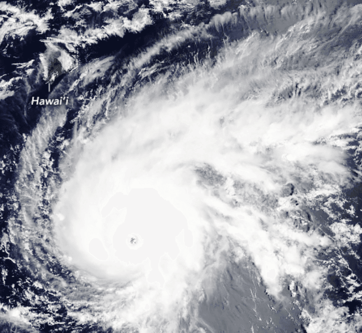
NOAA’s 2026 Central Pacific outlook, calling for a 70% chance of above-normal activity with 5–13 tropical cyclones fueled by El Niño conditions and elevated sea-surface temperatures, forms the main driver behind the 60% market-implied probability of at least one hurricane landfall in Hawaii before 2027. The current Invest 93C, recently upgraded to Potential Tropical Cyclone One-C or Tropical Storm Lala and tracking west-northwest toward the islands, adds near-term risk during peak season. While direct Category 1+ landfalls remain climatologically rare, with only a handful recorded since 1950, the elevated basin-wide activity and steering patterns that favor westward tracks increase the odds of a system reaching Hawaii’s coasts or immediate nearshore waters through November. Traders weigh these factors against historical analogs and model consensus on intensification and track, with resolution hinging on official National Hurricane Center or Central Pacific Hurricane Center designations of hurricane-strength winds at landfall.
Experimental AI-generated summary referencing Polymarket data. This is not trading advice and plays no role in how this market resolves. · UpdatedWill a hurricane make landfall in Hawaii before 2027?
Will a hurricane make landfall in Hawaii before 2027?
A hurricane is a tropical cyclone with maximum sustained winds of 74 mph or greater (Category 1 or higher on the Saffir-Simpson Hurricane Wind Scale), as described at https://www.nhc.noaa.gov/aboutsshws.php, and a hurricane landfall is said to occur when the hurricane's surface center intersects with the coastline, as described at https://www.nhc.noaa.gov/aboutgloss.shtml#LANDFALL. A storm must hold hurricane strength (Category 1 or higher on the Saffir-Simpson scale) at the moment its surface center intersects the coastline for that landfall to qualify.
"Hawaii" means the entire State of Hawaii as recognized under U.S. law, including the main Hawaiian Islands (Hawaiʻi, Maui, Oʻahu, Kauaʻi, Molokaʻi, Lānaʻi, Niʻihau, and Kahoʻolawe) and the Northwestern Hawaiian Islands (including Midway Atoll and the Papahānaumokuākea Marine National Monument).
The wind speed at the moment of landfall will be determined from the CPHC advisory or Special Advisory in effect at the time closest to the reported landfall time; where no advisory covers that exact moment, the most recent advisory issued prior to landfall governs.
This market may resolve based on the initial CPHC advisory reporting a qualifying landfall regardless of any later advisory, retraction, best-track revision, or reanalysis that revises that storm's intensity downward at the time of landfall. However, if a subsequent advisory or correction identifies a qualifying landfall that was not reflected in initial reporting, this market will resolve to "Yes" based on that correction.
Market Opened: Jul 24, 2026, 11:28 AM ET
Resolver
0x65070BE91...A hurricane is a tropical cyclone with maximum sustained winds of 74 mph or greater (Category 1 or higher on the Saffir-Simpson Hurricane Wind Scale), as described at https://www.nhc.noaa.gov/aboutsshws.php, and a hurricane landfall is said to occur when the hurricane's surface center intersects with the coastline, as described at https://www.nhc.noaa.gov/aboutgloss.shtml#LANDFALL. A storm must hold hurricane strength (Category 1 or higher on the Saffir-Simpson scale) at the moment its surface center intersects the coastline for that landfall to qualify.
"Hawaii" means the entire State of Hawaii as recognized under U.S. law, including the main Hawaiian Islands (Hawaiʻi, Maui, Oʻahu, Kauaʻi, Molokaʻi, Lānaʻi, Niʻihau, and Kahoʻolawe) and the Northwestern Hawaiian Islands (including Midway Atoll and the Papahānaumokuākea Marine National Monument).
The wind speed at the moment of landfall will be determined from the CPHC advisory or Special Advisory in effect at the time closest to the reported landfall time; where no advisory covers that exact moment, the most recent advisory issued prior to landfall governs.
This market may resolve based on the initial CPHC advisory reporting a qualifying landfall regardless of any later advisory, retraction, best-track revision, or reanalysis that revises that storm's intensity downward at the time of landfall. However, if a subsequent advisory or correction identifies a qualifying landfall that was not reflected in initial reporting, this market will resolve to "Yes" based on that correction.
Resolver
0x65070BE91...NOAA’s 2026 Central Pacific outlook, calling for a 70% chance of above-normal activity with 5–13 tropical cyclones fueled by El Niño conditions and elevated sea-surface temperatures, forms the main driver behind the 60% market-implied probability of at least one hurricane landfall in Hawaii before 2027. The current Invest 93C, recently upgraded to Potential Tropical Cyclone One-C or Tropical Storm Lala and tracking west-northwest toward the islands, adds near-term risk during peak season. While direct Category 1+ landfalls remain climatologically rare, with only a handful recorded since 1950, the elevated basin-wide activity and steering patterns that favor westward tracks increase the odds of a system reaching Hawaii’s coasts or immediate nearshore waters through November. Traders weigh these factors against historical analogs and model consensus on intensification and track, with resolution hinging on official National Hurricane Center or Central Pacific Hurricane Center designations of hurricane-strength winds at landfall.
Experimental AI-generated summary referencing Polymarket data. This is not trading advice and plays no role in how this market resolves. · Updated
Beware of external links.
Beware of external links.
Frequently Asked Questions